Heritage
Archive →Graysville, Cardiff, and Brookside sit in a row along the last stretch of Five Mile Creek, and two of them are here because somebody found coal under the farmland and could not hire enough men to dig it. Cardiff's owners wrote home to Wales and Scotland. Sloss sent its recruiters for Brookside to the far side of the Austro Hungarian Empire. Graysville had a cotton gin and never had a company at all. What came of it was a Russian Orthodox parish in Alabama, families from four countries living in a town of a few hundred people, and three places that have been arguing with the water ever since.
The coal did not stop where the charters did. Sloss worked the mine at Coalburg with prisoners leased from Jefferson County, and the slope at Republic was for a while the largest coal producer in the county. Thirteen more places sit along this creek besides the three that filed papers, and in the 1890 census the two biggest of the lot were Coalburg and Blossburg. Republic is also where the creek is measured, so every reading of the water on this site comes from there.
None of this is here for decoration. These towns were shaped by decisions made somewhere else, by companies, railroads, and the county, and that has not changed. Knowing how it went the last time is the best preparation there is for the next.
- ⛏️The whole run, in order. The 1830s to now, each stretch of years on its own page.
- 🏘️Three towns. Graysville, Cardiff, and Brookside, set side by side.
- 🌊Sixteen along the creek. Every community from Coalburg down to the Graysville end, chartered or not.
- 📚Every entry sourced. Where a date is not known, the page says so plainly.
There is a good chance somebody reading this knows an answer these pages do not.
The chapters
1830s to nowWhat follows is the whole run in order, from the first farms on the bottomland to the greenway that goes over the old rail bed. Each chapter takes a stretch of years and sets the three towns inside it together, because they happened to each other. The mine at Cardiff opened six years before the one at Brookside. Graysville lost its charter seven years after the Brookside mine shut.
One company runs through most of it. Sloss ran the prison mine at Coalburg, bought the Brookside mine a year after it opened, and counted Cardiff among its camps as well.
Each chapter opens onto its own page, where the full dated record for those years is kept, every entry carrying the source it came from and a link to go and read it. The record is not evenly thick and the count under each chapter says how thick: Brookside was a Sloss town and got written about, Graysville was neither, and some decades of it are close to blank.
Before the coal
to 1879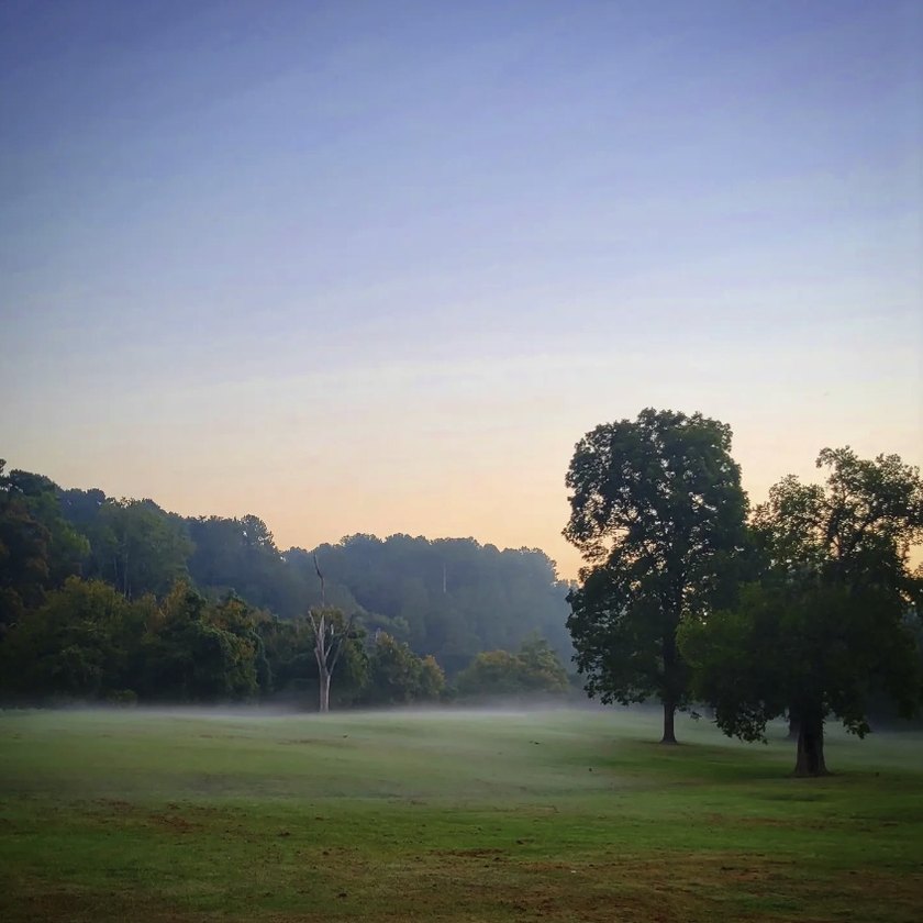
It is easy to assume the coal was always the point here. For about fifty years it was not. Two of the three towns already had people living in them, and neither of them had any reason yet to be a town.
Read this chapter 4 entriesThe camps
1880 to 1889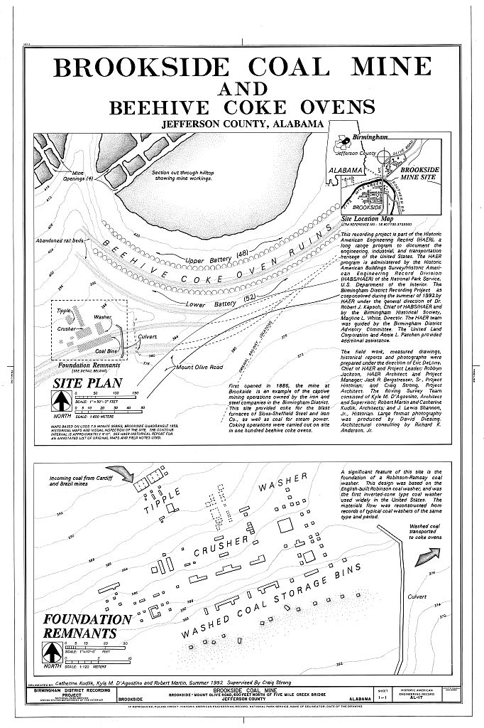
Cardiff went first. Two men bought the land in 1880, opened a mine, named it for home, and then filled the town by writing letters to Wales. Six years later Brookside did the same thing on a larger scale, and Sloss money was behind it inside a year.
Read this chapter 7 entriesCharters and churches
1890 to 1899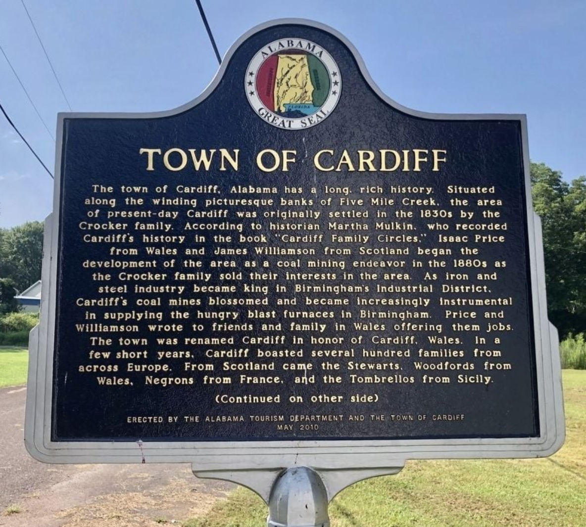
This is the decade the camps became towns. All three took a charter inside ten years, and the families filling Brookside's houses had come from the far side of the Austro Hungarian Empire to do it.
Read this chapter 11 entriesThe peak
1900 to 1919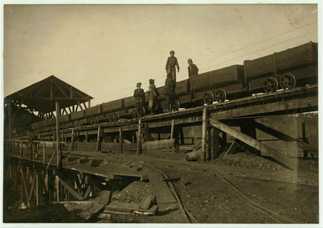
For twenty years the valley ran at full tilt, and then the men who ran it underground organized and the state came for them. Nearly everything these three towns still get measured against was built, counted, or finished inside these twenty years, which is also why the stretch ends the way it does.
Read this chapter 15 entriesThe mine closes
1920 to 1929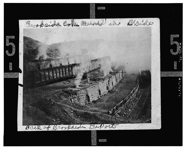
It ended inside a year. The mine that built Brookside closed in 1920 and never reopened, the ovens came down, and seven years later the state took Graysville's charter away.
Read this chapter 5 entriesAfter the coal
1930 to 1999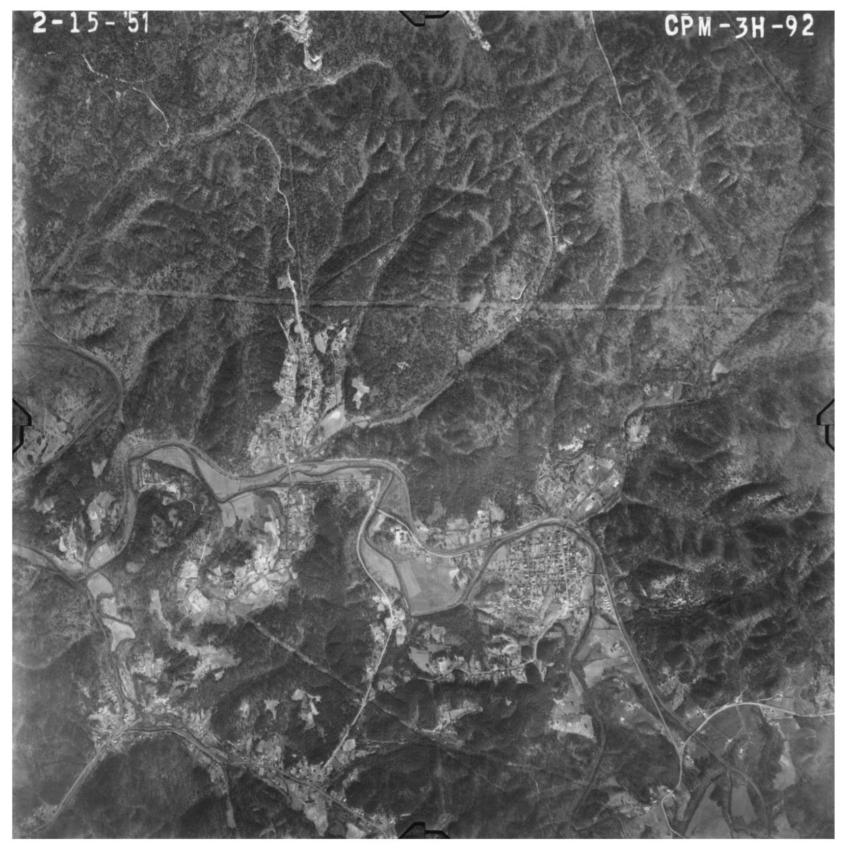
Seventy years in one chapter, because the three spent it going three different ways. Cardiff emptied out, Graysville came back from the dead and grew, and Brookside held on and reached its own high water mark in 1980.
Read this chapter 10 entriesThe creek comes back
2000 on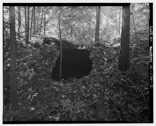
The creek that ran past the mines is the thing being cleaned up and walked along now, and the rail bed that hauled the coal out is the trail. None of which has stopped the creek flooding, and in 2003 it put water through downtown Brookside.
Read this chapter 13 entriesThe three towns
West to eastThe same three places side by side, which is the comparison the chapters keep making and this is the short version of. They were built for different reasons and they went different ways, and that is the part that gets flattened when people say the coal towns. Graysville had a gin, never belonged to a company, and is the largest of the three today. Cardiff was one mine and is now fifty two people. Brookside belonged to Sloss inside a year of its mine opening, and the parish its miners founded still puts on a food festival every November.
Incorporated twice
The one that was never a company town. Graysville had the gin, and it kept a farm town's shape while its neighbors were being built around a mine shaft. It is also the only one of the three that has had to incorporate twice.
One mine, and one fire
Named by a Welshman for the place he came from, built on one mine, and lost its downtown to fire in 1919. Cardiff has about five hundred fewer people now than it had the year it took its charter.
The company town
A Sloss company town that ended up with a Russian Orthodox parish, a Catholic parish, and two hundred coke ovens, because the coal needed miners and the miners were in eastern Europe.
Along the creek
Sixteen places sit along this creek between Coalburg and the Graysville end, and three of them filed incorporation paperwork. That is the whole of the difference, and it is smaller than it sounds. In the 1890 census Coalburg had 842 people and Blossburg had 692, while Brookside and Cardiff together had 583. The Warner slope at Republic was for a while the largest coal producer in Jefferson County. None of those three ever took a charter.
There are sixteen because nearly every hill and holler along here had coal under it, and a mine wanted its men living inside walking distance of the pit. A name, a post office, a row of houses, and then the seam ran out or the company went elsewhere.
What became of them is mostly in the census, which for several is the only place they appear at all. Coalburg was counted once, 842 people in 1890, and never again. Blossburg the same, 692 and then nothing. Pinkney City was counted twice, in 1910 and in 1930, and then stopped. Coalburg itself is largely inside Birmingham now. Republic and Watson are still outside everybody, and in 2011 they turned out against an annexation bill and killed it.
What follows runs downstream, Coalburg first and the Graysville end last, and each place gets as much as the record carries. For several of them that is a post office and a date. For three it is a name on a map and nothing else, which is said here rather than left out, because somebody reading this may know the rest of it.
-
1866 to 1932
Coalburg
Coalburg is the oldest of these and the largest any of them got, and it starts with Mack Holmes. Holmes had been enslaved. He took up an 80 acre tract here at a dollar and a quarter an acre under the Southern Homestead Act of 1866 and farmed it, along with other land he had bought in North Birmingham. When it was worked out that his tract sat over what was called a magnificent vein of coal, Holmes leased the mineral rights to John T. Milner's Milner Coal, Iron and Railway Company for $250 a month.
Milner is worth a second of your time here. In the late 1860s he published an argument for keeping Black laborers in what he called a semblance of bondage, and that argument is more or less the convict lease system that later filled this mine. He made more than $200,000 selling Coalburg. Standing for the state senate twenty years on he campaigned against convict leasing, and told a crowd that the principal object of his speech was the great necessity of maintaining white supremacy in the South.
Milner sold out in 1883. The mines at Coalburg and New Castle went to the Georgia Pacific Railway along with 13,000 acres of Richmond and Danville Construction Company land, for more than $200,000. The railway set up the Coalburg Coal and Coke Company, put Edward M. Tutwiler in as superintendent, and a post office opened here the same year and ran until 1932. Tutwiler went on to open mines at Brookside, Blossburg, Cardiff and Brazil, and Sloss ended up with all of them. The company that opened the Brookside mine in 1886 was called Coalburg Coal and Coke.
Sloss worked Coalburg with prisoners leased from Jefferson County, about 320 of them at the peak in 1889, bringing up 4,000 tons a day. Men were arrested on small charges, sold to the company, and sent underground. Nearly all of the county's prisoners were Black. Thomas Parke published a scathing report for the Jefferson County Medical Society on the conditions they worked in, and in 1895 put the death rate at Coalburg at 90 men for every 1,000 prisoners. Between 1899 and 1902, more than 100 leased men died there. Most of their names are gone.
A powder magazine blew up inside the mine on March 3, 1890 and killed eleven men. The county coroner, Alfred Babbitt, and the Alabama Board of Penitentiary Inspectors looked into it. Edward Tutwiler, who ran the place for the railway and then for Sloss, lived in a cabin among the laborers and went to every workers meeting, and contemporary accounts praise him for it. His wife Mary died at Coalburg in 1885. There were 214 coke ovens at Coalburg by 1900, and in 1889 Sloss had put in a bank of 63 mechanically charged ovens of a patented design that the Library of Congress survey reckons may have been the first of its kind in the country. The census counted 842 people here in 1890, more than Brookside and Cardiff had between them.
Coalburg is largely inside Birmingham now, in the Hooper City neighborhood, just north of where I-22 meets Coalburg Road.
The Equal Justice Initiative has written about convict leasing in Jefferson County, and Coalburg is in it.
-
1898 to now
Republic
Republic was called Warner first. The Pioneer Mining and Manufacturing Company opened its first mines in the back half of 1898, and the two it started with were Sayreton and the Warner slope here. By 1900 Warner was the largest coal producer in Jefferson County. In 1901 it sent out 344,357 tons on its own, which was more coal than every mine in Alabama put together had raised in 1880.
Republic Iron and Steel bought the company in 1899 and the place took the new owner's name. The post office opened as Republic in 1903 and ran to 1968. There is a photograph of a slope mine here from 1908, captioned for the Warner Coal Company.
Republic is unincorporated and it has not been quiet about it. In 2011 Graysville asked the legislature for leave to annex more than 2,000 acres in northwest Jefferson County, including Republic land that does not touch the Graysville line, along Forestdale Bend Road and Cherry Avenue. People in Republic and Watson objected and the bill never came to a vote.
The creek level on this site comes from Republic. The gauge there is the only one left reporting live water anywhere in the watershed, so every time you check the creek here, you are looking at Republic.
-
—
New Town
New Town sits a few hundred yards off the water between Coalburg and Brookside. The US Geological Survey's names file carries it and OpenStreetMap carries it, and that is all that has turned up. It is not in the University of Alabama's list of Jefferson County places, there is no post office on record for it, and no date has come to hand for when anybody started calling it that.
-
—
Dogtown
Dogtown is in the University of Alabama's list of Jefferson County places with a map reference beside it and no remark, which is that list's way of saying the name is real and the compiler had nothing to add. The names file puts it on the bank between Republic and Mineral Springs. No post office, no founding date, and no account of who was there has turned up.
-
1908
Mineral Springs
Mineral Springs first appears on a map dating from 1908. That is the whole of the record in the sources this page uses. There is no post office on file for it and nothing that says what was at the spring.
-
1903
Watson
Watson had a post office from 1903. These sources do not say when it closed or who Watson was, though the building was still standing to be photographed in 2021.
Watson is unincorporated and turned out against being annexed. When Graysville went to the legislature in 2011 for land along Forestdale Bend Road and Cherry Avenue, people here objected alongside Republic, and the bill died without a vote.
-
—
Scarlet Town
Scarlet Town is carried by the US Geological Survey's names file and by OpenStreetMap, a few hundred yards from the creek above Brookside. It is not in the University of Alabama's list, and no post office, date, or account of it has turned up anywhere else.
-
1983
Daisey City
Daisey City first appears on the 1983 edition of the county highway map, spelled with an e, which is also how the names file spells it. Nothing older than that has turned up in the sources this page uses.
-
1886 to now
Brookside
Brookside is named for the creek that runs through it. The Coalburg Coal and Coke Company opened the mine in 1886 and Sloss bought it the year after, and the town took its charter in 1898. The census counted 380 people here in 1890 and 1,253 in 2020.
Brookside’s miners were United Mine Workers, and in July 1908 more than a thousand of them drove thirty deputies back out through the Jefferson Tunnel. That fight, and the strike the state broke to end it, are in The peak.
-
1910 to 1930
Pinkney City
Pinkney City is the odd one here, because it has census figures and almost nothing else. The census counted 358 people in 1910 and 177 in 1930. The University of Alabama's list has the name first appearing on a map dating from 1922, which is later than both of those counts, and nothing found so far says who Pinkney was or what the place was built around.
-
1880 to now
Cardiff
The Crocker family settled here in the 1830s and sold the land in 1880 to two coal prospectors, Isaac Price and James Williamson. They opened the Cardiff mine, and Price, who was Welsh, named it for home. The labor came from Wales and Scotland and also from France and Italy, and the place grew quickly once Sloss took the mine over. The post office opened in 1890 and the charter came in January 1900, the year 562 people were counted here. In 2020 it was 52.
Cardiff still has its own ZIP code, 35041, but the mail has come through the Brookside post office since the creek flooded in 2003. The town hall was damaged in that flood. In October 2017 eight residents petitioned Judge Alan King to dissolve the municipality.
-
1889 to 1968
Blossburg
Blossburg is named for Blossburg in Pennsylvania, which was a coal town first. It was one of the mines Sloss had opened or bought by 1893, and it ended up the largest of them for coke: 350 ovens by 1900, against 214 at Coalburg and 99 at Brookside. The census counted 692 people here in 1890, more than Brookside and Cardiff had between them. The post office ran from 1889 to 1968, close to eighty years for a place that never filed a charter. The mine outlasted Sloss's interest in it. Erskine Ramsay, the engineer who put the coal washer into Brookside, held Blossburg in his own portfolio and folded it into the Pratt Coal Company when he reincorporated that in 1902.
-
1897 to now
Graysville
Graysville was Gintown before it was Graysville, after the only cotton gin for miles around, and the name it took instead was a local family's. It is the one of the three that never belonged to a company, and the only one that has had to incorporate twice: chartered in 1897, stripped of the charter in 1927 for inactivity, and chartered again on November 17, 1945, mostly so it could build itself a water system. The post office opened in 1942. The census counted 319 people here in 1900 and 1,950 in 2020.
It still runs its own gas and water utility, and put a gas flame and a water tap on the town seal to say so.
-
1928 to 1981
Alden
Alden was built as a mining camp in 1928 by Sloss-Sheffield Steel and Iron, for the men working its Flat Top mine. That makes it the last place on this creek put up around a mine, and it went up nearly fifty years after Coalburg. The company built 160 houses and a concrete man way 981 feet long running down to the mine entrance. The post office ran from 1934 to 1981.
The name came out of a conversation between the superintendent, Howard Thomas, and the chairman, Hugh Morrow, who had offered fifty dollars for a good one. Thomas suggested his daughter's. Ruth Alden was ten years old, and she was guest of honor at the opening gala.
-
1887 to 1906
Linn Crossing
Linn Crossing has gone by four names. It was Chetora and it was Ono. Its own post office ran from 1887 to 1895, a Linn post office took over in 1895, and an Ono post office ran from 1895 to 1906. Nobody has turned up who Linn was.
The creek has been sampled at Linn Crossing since June 1964, and that station's record runs to 2006. Those readings are in the creek room with everything else taken off this water.
-
1937
Chetopa
Chetopa first appears on the 1937 edition of the county highway map, and it is a different name from Chetora, which was Linn Crossing just down the road. The names file carries a Chetopa Mine impoundment about a mile east of it, so there was a mine. Nothing found so far dates it or says who worked it.
This is assembled reading rather than original research, and the difference is worth being plain about. Everything here comes from material that is public and online: the Encyclopedia of Alabama, Bhamwiki, Wikipedia, the Library of Congress, the University of Alabama's list of Jefferson County places, the census, the Freshwater Land Trust, the Equal Justice Initiative, the US Geological Survey, and the marker standing on the roadside in Cardiff. Every entry carries the one it came from with a link, so none of it asks to be taken on trust.
That leaves a great deal out. When a chapter says something is not recorded, it means it has not turned up in any of those, not that nobody ever wrote it down. Courthouse deeds, church registers, company payrolls and the boxes in people's closets are mostly not on the internet, and a good deal of what actually happened in these towns is only in them. Where the sources disagree with each other, which they do on a couple of the population counts, this page follows the census.
That rule earned its keep on the incorporation dates. The University of Alabama's list has Graysville incorporating in 1946 and Brookside in 1896, where this page says 1897 and 1898. The census counted Graysville in 1900 and again in 1910, so 1946 cannot be the first charter and 1897 stands, and the 1946 in that list is the first sitting of the council, on January 16, 1946, seven weeks after the second charter on November 17, 1945. Brookside the census cannot settle, because it counted the place in 1890 and in 1900, on both sides of both dates. Neither does the weight of the sources: the Encyclopedia of Alabama and Wikipedia say 1898, Bhamwiki and that same University of Alabama list say 1896. This page prints 1898. If the incorporation act itself turns up and says otherwise, it will print that instead.
So if you know one of these answers, there is a fair chance you know more about it than this page does. That is not a problem with the page so much as the shape of the thing, and it is why the address at the bottom is there.
- Alabama Communities of Excellence, Graysville
- Alabama News Center, Five Mile Creek Greenway now the longest multiuse trail in Jefferson County
- Bhamwiki, Brookside
- Bhamwiki, Brookside mine
- Bhamwiki, Cane Creek Branch
- Bhamwiki, Cardiff
- Czechoslovak Genealogical Society International, Slovaks and Carpatho-Rusyns in Brookside, Alabama
- Encyclopedia of Alabama, Birmingham District Coal Strike of 1908
- Encyclopedia of Alabama, Brookside
- Encyclopedia of Alabama, Cardiff
- Encyclopedia of Alabama, Graysville
- Freshwater Land Trust, District purchases rail corridor, opens new trail
- Freshwater Land Trust, Five Mile Creek
- Library of Congress, Brookside Coal Mine, Beehive Coke Ovens, Mount Olive Road north of the Five Mile Creek bridge
- Town of Cardiff marker, Erected by the Alabama Tourism Department and the Town of Cardiff, May 2010
- Wikipedia, Brookside, Alabama
- Wikipedia, Cardiff, Alabama
- Wikipedia, Graysville, Alabama
Fill in a gap
If you have a photograph, a date, a name, or a story about any of the three towns, send it. Corrections are just as welcome as additions, and this page gets better every time somebody who was there writes in.
fivemilec@gmail.com